1.Research Area

The Mekong River Basin and Southeast Asian countries have always been the “hot spots” of international water resources and ecological research. Coupled with the rapid economic development in recent years, the water resources system has been seriously affected and the following related issues have been continuously concerned: food and electricity caused by population growth. Increased demand (especially hydropower) (Fant et al., 2016); land use change and water conflicts caused by large-scale rice planting and high-speed urbanization (Hauser et al., 2017); low-efficiency agricultural irrigation Potential threats to regional food security and global food supply (FAO, 2011) Water shortages and floods during the season (Anond, 2011); inadequate water resources management and ecosystem degradation due to water and hydropower construction (Kong et al) . 2017); Impact of high arsenic groundwater irrigation on human health and food security (My et al., 2017); extreme water events caused by climate change and impacts on food security and environmental pollution (Tukimat et al. , 2017).
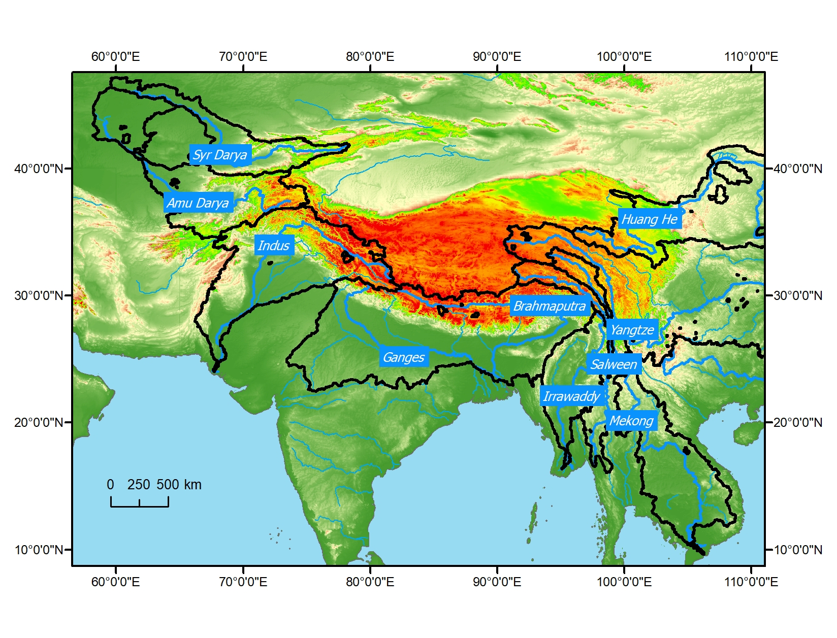
The Mekong River is the most important river in the landlocked countries of Southeast Asia. As the tenth largest river in the world, the Mekong River originated in the Qinghai-Tibet Plateau, passing through three provinces in China and passing through Myanmar, Laos, Thailand, Cambodia, and finally into the South China Sea in Vietnam. The Mekong River Basin covers an area of 759,000 square kilometers and is divided into upper and lower parts. The upper reaches of the Mekong River include the Qinghai-Tibet Plateau, the Sanjiang area, and the Lancang River Basin in China. Downstream includes the northern highlands (Myanmar, Thailand, Laos), the Nakhon Ratchasima (Thailand), the Tonle Sap Lake Basin (Cambodia), and the Mekong Delta (Vietnam).
Most of the annual runoff of the Mekong River comes from the downstream part, and the contribution from the upstream part is only about 20%, and the contribution of the upstream meltwater in the dry season can exceed 24%. The downstream area has a tropical monsoon climate with an average summer temperature of 30 ° C to 38 ° C, while the average winter temperature is around 15 ° C. The average annual rainfall is higher in the east than in the west. For example, in Laos and Cambodia, the average annual rainfall is around 3000 mm; in Thailand, it is 1000-1600 mm.
The June to November of each year is the flood season of the Mekong River Basin. Unlike other river basins in the world, in addition to threats to agricultural production and food security, floods have created the world-famous Mekong River freshwater fishery. Shahzad (2014) reviewed computer models for the Mekong River flood forecasting, such as SSARR and URBS models. Drought is harmful to the basin compared to floods. The severe drought in the lower reaches of the Mekong River is frequent and causes far more losses than the floods (International Water Management Institute, 2016).
The region is also extremely sensitive to climate change. According to forecasts for the next 20 to 30 years, rainfall in the Mekong River Basin will increase by 13.5%, runoff will increase by 21%, and temperature will increase by 0.79 °C (Mekong River Comission, 2016). Many scholars in the region have also given the conclusion that the region will become more wet and hot under the influence of climate change (Kattelus et al., 2015; Västilä et al., 2010). This will affect the ecological and agricultural production of the entire Mekong River Basin, further exacerbating the challenge of ensuring regional water security. Currently, the response measures in the region are mainly agricultural and regional water resources management and water disaster prevention (International Centre for Environmental Management, 2014).
The Mekong River is of great significance to the production and life of residents along the line. Only the lower reaches of the Mekong River have a population of 60 million, of which 40% live within 15 kilometers of the Mekong River. However, due to various water conflicts, the issue of drinking water and electricity safety in the region (The Economist Intelligence Unit, 2017). Currently, 20% of the population still lives below the poverty line. The Mekong River Commission (2016) is working on joint regional water resources management.
Agricultural production is critical to ensuring food security in the region to address poverty. To address flood control, soil erosion and fisheries farming, rice has become the main crop in the region with an area of over 10 million hectares. In addition, cassava, sugar cane, soybeans and corn are also grown in the region, but given the output and contribution to regional food security, the area planted is far less than rice. Although individual regions have higher food production, such as the Delta region of Vietnam, food production in most regions is affected by poor soils and water shortages, especially in Cambodia, northeastern Thailand, central Laos, and central highlands in Vietnam. Therefore, irrigation has become the main use of water in the lower reaches of the Mekong River, accounting for more than 70% of the total water use in the region and is dominated by the Mekong Delta. At present, the area of irrigated land in the lower reaches of the Mekong River is about 4 million hectares, and it has a steady growth every year in various countries. In the future, how the irrigated area will change in the region will be affected by those factors, and how the corresponding water resources should be managed has also received the attention and research of scholars.

The increase in energy demand brought about by population growth, combined with carbon dioxide emissions, makes hydropower an important source of energy for the region. However, the lower reaches of the Mekong River have two different sounds for hydropower. On the one hand, hydropower is a clean energy source, and the economic benefits of abundant water resources can also help solve the problem of poverty. On the other hand, hydropower projects also have an impact on the local environment, fisheries and residents' lives (Xu et al., 2009; Ziv et al., 2012).
Fisheries are a major industry in the region and a major source of protein food for residents of the region. In Laos, fishery production accounts for 7% of the country's GDP. In Cambodia, the proportion is as high as 12%, which has already exceeded rice cultivation. At the same time, the development of fisheries has also driven other related industries such as food, retail shipbuilding and fishing gear industries. The demand for water resources in fisheries has led to fierce competition with agricultural irrigation, residential and industrial water use. In the case of increasing regional population, how to ensure the safety of fisheries in the region is particularly important. In addition to the current factors affecting fisheries in the region are river sediments, water pollution, overfishing, drought, etc. (Dudgeon, 2011).
As the tenth largest river in the world, the Mekong River is rich in natural resources, including 20,000 species of plants, 430 species of mammals, 12,000 species of birds, 800 species of crawling and amphibians, and 850 species of fish. Among them, there are many endangered species, such as Mekong giants and short-nose dolphins. However, many potential threats include intensive agricultural irrigation, pesticide application, development on the main river (such as reservoirs), overfishing, and unpredictable climate change, which make the environment and ecology of the Mekong River Basin vulnerable. Uncertainty (Coates et al., 2003; Dugan et al., 2010).
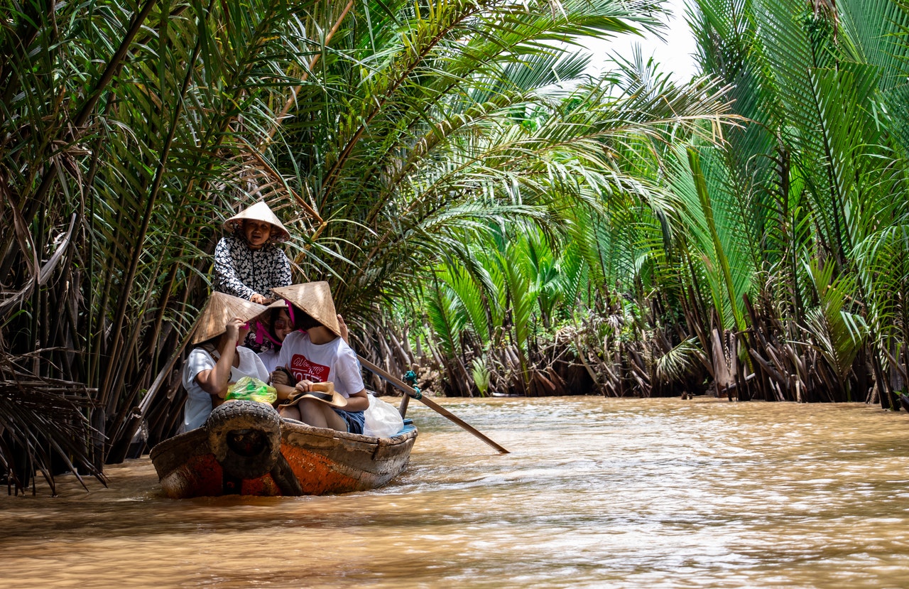
In the lower reaches of the Mekong River, Mekong River shipping is the main mode of transportation in the region. In Vietnam, 73% of goods and 27% of passengers rely on waterways every year. At the same time, as a link between China Unicom and the Mekong River Basin countries, shipping also plays an important role in international trade and tourism. However, the narrowness of the river and the rushing part of the water, sediment deposition and changes in water levels pose a significant threat to shipping in the region (Manh et al., 2014). The countries concerned have also taken many measures to ensure the safety of shipping, including providing safe assistance in dangerous river sections and signing international agreements to improve shipping efficiency. At the same time, it can reduce the river pollution caused by shipping accidents.

At present, the research on water resources in the Mekong and Southeast Asian countries shows more natural hydrological systems on the side of “supply and water” (Hasson et al., 2013; Räsänen et al., 2017; Schubert et al., 2017), less The study of socio-economic systems on the “demand, water” side (Li et al., 2017), especially the lack of natural-human coupling systems. Under the uncertain conditions of increasing human activities and uncertain climate change trends, how do the two interdependent systems of nature and humanity interact with each other, and what kind of driving mechanism and influence mechanism there are, we are not yet clear. This has largely constrained the overall and accurate understanding of the characteristics of the hydrological and water resources systems in the region. On the other hand, how to move from traditional data mining to the research behind the mechanism, especially how the two systems of nature and humanity interact, to achieve sustainable development of water resources in the region, to ensure water, food, energy and ecological security Important role.
2.Overall Goal
This topic is a topic in the project “Sixth pole environmental change and green silk road construction” special project “Western wind and monsoon interaction and water resources change” (6). Climate and water resources change is an important research content of the project (6), and it is one of the core issues of concern to the countries in Southeast Asia. It is also a hot issue of international scholars. Southeast Asia includes many countries along the “One Belt, One Road” strategy along the route. Scientific and comprehensive understanding of the climate, water resources and ecological environment systems in the region, especially in the context of climate change and the impact of human activities, to ensure the water resources and ecological security of the region, to achieve sustainable development of regional countries, and to ensure The “One Way” strategy benefits countries along the route to play a vital role.
The study of the fine simulation and evolution of climate change in the pan-third pole and Southeast Asia is an important basis for uncovering the spatial and temporal evolution mechanism of water resources in the region. It is also an important basis for exploring the spatial and temporal distribution and change of water resources in the future and nature-humanities. The spatial and temporal evolution of water resources under coupled systems is a concentrated expression of climate change and human activities, and is also the main reference for formulating scientific and rational regional water resources development and protection policies. The two complement each other and rely on each other.
This topic is based on other topics (such as "Westerly and monsoon interaction and water vapor transport process", "Asian water tower changes and their impact", "Central Asia Great Lakes water-ecological system interaction and collaborative management"), combined with Southeast Asia. The region, the deep analysis and in-depth study of the climate and water resources most concerned about the project and the ecological environment effect of water resources utilization, has an important and irreplaceable position at the project level, and the research results can directly serve the green “One Belt and One Road”. The country needs to build a major demand. Therefore, it is very necessary to carry out research work on this topic.
In 2018, the main tasks, detailed work plans and task decomposition plans for the implementation of the project; organization and coordination of field research and research in the study area, water samples and soil samples collected at specific locations; collection of research areas for remote sensing, hydrology, meteorology, socio-economic and other foundations Data, establish a data sharing mechanism within the project, carry out database construction; pre-process data collection and carry out remote sensing interpretation; carry out regional climate model installation and commissioning; and build a socio-economic development path based on IPCC to develop economic and social development scenarios in Southeast Asia.
In 2019, we will further carry out research on field investigations in the study area, continue to collect relevant basic data, and sample the second-year planning locations; further improve the construction of the basic database and realize database sharing between topics: Carry out research on the co-evolution mechanism of water-society-ecosystem, and provide the basis for the development of natural-human-coupling hydrological model model; use multi-source satellite data combined with digital interpretation technology to extract the basic information of the underlying surface to provide basic information of the underlying surface for the hydrological model; Conduct groundwater recharge mechanism analysis and surface water-groundwater coupling research to provide theoretical methods for surface water ground coupling in hydrological models; nested dynamic downscaling of research areas; key technical discussions for first-year and second-year research work And plan a follow-up research plan.
In 2020, based on the GEPIC model, the water-society-ecosystem co-evolution module and the surface water-groundwater coupling module will be developed to develop a new generation of natural-human-complex system hydrological model; using the collected observation data combined with remote sensing products for a new generation of high precision. The distributed model is used to determine and verify the Mekong River basin scale and the five countries in Southeast Asia. It simulates the basic hydrological elements of the five Southeast Asian countries and the Mekong River Basin, and analyzes the spatial and temporal evolution of water resources based on the results of hydrological and water resources simulation data; using key factor identification techniques and attribution methods. The method analyzes the natural and human-driven mechanism of water-time change in water resources. On the basis of historical simulation of hydrology and water resources, the multi-model collection method is used to construct the future water resources estimation system and carry out future water resources simulation.
Research on climate change and global climate change in the pan third pole and Southeast Asian countries in 2021; establishing statistical relationships between large-scale circulation, global climate change, and temporal and spatial changes in the climate of the third and Southeast Asian countries; combining CMIP5/6, CORDEX, and the scaled-down climate projection generated by the project will be refined and integrated into the climate of the third-polar region; combined with the system dynamics to develop the water resources utilization module under the socio-economic system, providing the basis for the natural-human-complex system water resource model. On the basis of the hydrological model of the human complex system, the module for water resources development and utilization is coupled to construct a water resource model of the natural-human-composite system; the future social development scenario is constructed, and the uncertainty of future scenarios of water resources is analyzed based on the multi-model set estimation; Study regional water resources simulation data to analyze the spatiotemporal pattern of water resources utilization under social and economic activities; combined with surface groundwater samples and soil sample analysis and test results, carry out research on high arsenic groundwater migration mechanism and analyze the ecological effects of high arsenic groundwater.
In 2022, different natural and humanistic scenarios will be set up; high-resolution climate change scenarios will be generated; a high-arsenic groundwater migration mechanism will be combined to construct a high-arsenic groundwater logistic regression prediction model; combined with a high-arsenic groundwater prediction model to predict future high-arsenic groundwater development. The ecological effects of the use; identify the natural variability of climate and the impact of human activities on water cycle and water resources, and quantify their relative contributions; combined with hydrological and water resources analysis, water use and ecological effects, comprehensive assessment of natural-human complex systems under Southeast Asia water Resources; write "South Asia Water Resources and Ecological Impact Assessment Report".
3.Expected Result
The expected results of this project include scientific research and capacity building. The specific results are as follows:
(1) Develop and improve the theoretical methods and technical systems for regional assimilation and climate downscaling, and provide a set of publicly available climatic factors with a spatial resolution of 9 km in the pan-third pole region and a spatial resolution of 3 km in Southeast Asia ( Data set of maximum temperature, minimum temperature, rainfall, etc.;
(2) Providing a climate change scenario with a spatial resolution of 25 km in the pan-third pole region;
(3) Constructing a simulation method and model software for water resources evaluation under the natural-human coupling system;
(4) Reveal the spatio-temporal pattern, evolution trend and natural human-driven mechanism of water resources in Southeast Asian countries, and predict the future situation of water resources change and its uncertainty;
(5) Reveal the spatiotemporal pattern of water resources utilization and its eco-environmental effects in Southeast Asian countries;
(6) Publish 25-30 SCI papers, and strive to publish influential academic papers in top international journals, leading the academic direction of water resources research;
(7) Concentrate and train a group of interdisciplinary young scientific and technological talents with international vision, and cultivate 4-8 postdoctoral fellows and 8-10 postgraduate students;
(8) Submit a report on the Southeast Asia Water Resources and Ecological Impact Assessment.
4.Major contributions
Generate a database of high-temporal resolution meteorological elements in the third pole and Southeast Asian countries, clarify the law of climate change within the pan-tripolar and Southeast Asian countries, and its relationship with large-scale circulation and global climate change, thus becoming the pan-third pole and Southeast Asia The research on the spatial and temporal evolution and driving mechanism of national water resources provides support.
The production of high-temporal resolution water resources and their utilization basic databases and related model software in Southeast Asia countries and the Mekong River Basin can provide basic support for water resources research in Southeast Asia; the research results can help understand the impact of water resources under the dual effects of climate change and human activities. The evolution of the law, distinguishing the natural and human-driven contribution of water resources change; the ecological effects of water use and the prediction of future water resources evolution can provide scientific support for water resources management in Southeast Asia, and ensure the green development of the “Belt and Road”.